![]()
![]()
|
The word is finally out--there is life
in the James River, and plenty of it. Finding it can be another matter.
This is one muddy river, especially after a rainfall sweeps down the
farmers' good topsoil and fertilizers. But even at its clearest, most
of its life stays hidden, visible mainly to biologists and fishermen
who can name what they see. Fortunately for me, they are tolerant souls
as a rule, who welcome questions from inquisitive river prowlers.
The fisherman shows me a concrete interceptor
sewer line that makes a convenient underwater sidewalk up the river.
By focusing on the minnows and tadpoles darting at the edge, my eyes
slowly adjust until I am ready to go find bigger game. As I shuffle
through the current, a long ugly gar sweeps fearlessly past my feet;
he and his kind have probably been here for centuries, but like other
inedible or "non-game" fish, they are rarely noted officially. I watch
with the fisherman for the colorful sunfish, brim, and smallmouth bass
to be tempted with his hook, but most seem intent on more promising
food than his bait. I turn over rocks, looking for the larvae of mayflies
and caddisfly cases, sure signs of a clean river, but either they are
not here or I do not yet know where and how to look. I am, after all,
still an apprentice at this.
First I was carefully instructed about
the psychology of smallmouth bass. One must assume that they are as
lazy as most people are, and so will bite only if the lure is danced
right in front or above them. Rarely moving far from the hole they have
staked as their territory, they will strike--at the right kind of lure
in the right spot--only once. Often they avoid the hook's dig, and they
will not make the same mistake twice, so the fisherman might as well
move on, casting again into another place where a bass might wait, suspended
against the current.
The theory was validated by practice,
because we found some of those bass; even this novice pulled in two.
Many more struck than we were able to hook, and some fought their way
free. Most that we did catch we sent back home to grow up some more,
but two measured more than the regulation twelve inches. My guide complained
that it was a slow, rather unproductive day, nothing like the cooler
autumn would be, but I was content. After an hour or two of getting
tangled in my line, I began to get the knack of casting. By then, though,
I had discovered that I preferred to try to penetrate the reflecting
water by looking, not fishing. Trying to visualize the underworld that
my fisherman friend could see was far more appealing than catching fish
that would have to be cleaned and eaten.
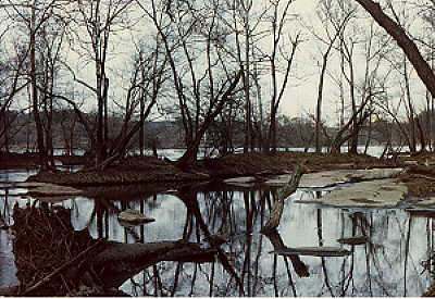
It is tempting to keep on floating in
this clear water, but I know that it is the lower James estuary, along
the river's curving and ragged low edges, where I must go to find the
heart of the river's life. Armed with canoe and boots, I poke into the
patches of marshes and swamps, the "wetlands" which stretch along the
river banks and the tidal creeks. The water, briny in varying concentrations,
is a nursery not only for the river but, to some extent, for the Chesapeake
Bay and even the Atlantic. In the deep mud and dark waters around the
tough grasses of the marshes, which grow on a thick rotting biomass,
is the abundant life at the base of the food chain which eats the fast-decaying
bits of grass and roots and the algae. This life, often microscopic
in size, in turn feeds the tiniest nursery animals spawned in the river
that cling to my dipping net. In nature, life often comes out of much
death.
Wetlands are not a very pleasant place
to be. I sink deeply into the pungent muds, hanging on to their hardy
grasses, and the canoe tips easily as I maneuver around the sharp bends
of the creeks, startling tiny crabs and frogs. Insects, especially mosquitoes
and hard-biting horse flies, seem bent on torment, no matter what the
season. But with luck I see the great blue herons, ospreys, and even
the eagle circling and feeding on this soggy, rich land. The marsh waters
may be too dark for me to detect much of their resident life, but the
sharper-eyed birds have no trouble spotting their prey.
Not long ago, say fifteen years, expeditions
to the river like these were difficult if not impossible to take. There
were simply few ways to reach the river bank legally anywhere along
its length. Fences and "No Trespassing" signs were the rule. The riparian
doctrine of English common law governs water rights in this state, meaning
that riparian owners are presumed to have the only legal rights to use
a natural watercourse unless it is navigable; and even then they can
prevent access to the river. Above the Fall Line, those owning land
on the riverbank can claim ownership to the river bottom and islands,
right to the middle of the water. The few who can produce deeds traceable
to the original royal grants dating before the eighteenth century--
and they do exist--can also legally claim the non-navigable stretches
of river bordered by their land and the life within it, including the
"royal fishes" if they should happen to appear. By tradition, then,
Virginia's title of "commonwealth" has not extended to its rivers.
Since most of the river's banks after
the canal closed were owned by large landowners, local government, lumber
companies, or the railroad, very few ordinary people could use the river,
even stroll its banks, for years. A dedicated nature-lover like Newton
Ancarrow (who was also a riparian owner) could get permission to prowl
around the river with his camera to take pictures of wildflowers, but
not many others tried, or even knew that the river might be worth the
trouble. There were always a few boys who found their way, legally or
not, especially poor ones with little else to do in the summer. I met
one of the Virginian Huck Finns on my first trip to the river a decade
ago, when he floated up in an inner tube. His skinny browned arms and
legs were covered with scars, each with a graphic tale of an encounter
with barbed wire, granite, and impetuous currents he was anxious to
tell. But most people have not had his daring, for they are bred to
respect property rights.
Ironically, it was a decision to put a
highway along the river that led to the opening of recreational access
along the Fall Line. In 1966, a housewife saw a dramatic picture of
the river near her home in the Richmond newspaper. Superimposed on an
aerial photograph of the river above Williams Dam, flamboyant in its
bright autumn colors, was a four-mile, four-lane parkway hanging over
the southern bank, with footbridges leading from a median parking lot
to the two islands. The headline read, "Expressway Opens Recreation
Vista." Her name was Louise Burke, and the Richmond Metropolitan Authority
had just met its match. She soon discovered that the narrow floodplain
in front of the bluffs along the river would have to be built up with
tons of fill dirt from the islands. Following the granting of federal
funds, the toll highway would be constructed ten feet above the so-called
"value-less" floodplain, blocking off one of the few stretches of river
in the city, or on the entire river, which was unofficially open for
public recreation.
That highway was never built, for Mrs.
Burke soon enlisted help from her neighbors, including R. B. Young,
a medical school professor. In 1970 they organized the Richmond Scenic
James Council, becoming one of the first citizen groups to "adopt" the
river. They lobbied effectively for increased public access and better
water use planning, not just in the city but with state legislators.
At their urging the Virginia General Assembly declared the Falls from
Belle Isle to the western end of the Fall Line in 1972 as a "historic
river with noteworthy scenic and ecological qualities," thus establishing
a Falls of the James Committee under Dr. Young to advise on decisions
affecting the part of the river running through the city. It took another
twelve years, but finally the Assembly finished what it had started,
officially designating the Falls as a "scenic river," giving it added
protection and a federal name. Soon the "historic" portion of the tidewater
James is likely to be awarded the same designation because of the efforts
of another group of riparian owners. People have rediscovered the pleasures
of their river, and few politicians would dare question their mandate
to declare it scenic.
Today, then, much of the life visible
on the river is in human form, especially in the James River Park which
stretches over 480 acres of riverbank and islands in six locations along
the Fall Line. High walkways span the railroad tracks and canal, descending
into what is left of a river wilderness. Upstream, the Audubon Society
has dug out a wetlands area which attracts both birds and birdwatchers.
Along the river, twelve access areas with parking and boat landings
have been opened by the Virginia Commission of Game and Inland Fisheries
with more scheduled for development. There are a few other privately
owned places open to knowledgeable canoers and fishermen. Recently the
Forest Service opened three primitive float-in campsites below Buchanan
on a favorite float section of the upper James. There is even a state
park in Surry County, but none yet on the piedmont or upper James. The
James is now one of the state's more accessible rivers. In spite of
what has been trashed or flushed into these waters for centuries, the
river species called Homo sapiens is flourishing, especially
in warm weather, indulging in swimming and wading, boating and fishing,
or just rock-sitting.
Public access has brought its problems.
Part of the tidewater James can be dangerously crowded with boats on
weekends, and aluminum cans and bottles often mark the trails of careless
boaters through clearer waters. Broken glass threatens waders in James
River Park, and each summer several people drown when they miscalculate
the power of the river's current. The familiarity that leads to seeing
and perhaps caring for the river has not always bred respect. Some people--and
Ancarrow is one--want to see the river closed again and allowed to return
to as wild a condition as possible. But people have already left their
marks, and they intend to continue enjoying the river they have recently
rediscovered,
Recently the city of Richmond debated
closing much of the access to the river at the Fall Line because of
the expenses the fire department has incurred trying to rescue people,
alive and dead, who have underestimated the power of the Class IV to
VI rapids, particularly at high water. A group of experienced canoeists
began working with the naturalist of the James River Park to figure
out a solution to the problem before one was forced on them. They had
signs painted and erected at each launching site that detailed the river's
hazards, stating that river users must wear life-jackets when the river
is over five feet high. Only canoers with whitewater experience can
now legally shoot the rapids when the river is over nine feet. Depths
are regularly marked, and the level of the river has become a regular
feature on evening television weathercasts. The organization teaches
whitewater techniques and polices the river during public whitewater
races. In turn, the city assesses fines on people who have to be rescued.
The compromise seems to be working, and the fire department has not
had as many excuses to go to the river lately.
Not all conflicts about who can use the
river have been so well reconciled, however, especially in times when
cost- benefit ratios govern decisions about water, and those decisions
are usually made in the many political jurisdictions through which the
river runs. There, planning often becomes a game of determining "who
gets what part of the river." Even when a group with a financial interest
in using the river is willing to listen to the claims of other interests,
one kind of use often endangers or eliminates others. It is both difficult
and expensive to reconcile dams with rafting and fish migrations or
waste disposal with swimming, fishing, and drinking the water. Relatively
innocuous river pleasures like swimming, fishing, boating, and watching
do not seem to pay off in dollars, yet they can require millions of
dollars, especially in heavily populated areas of the river basin, to
keep the water clean enough.
For every form of wildlife visible in
and around the river, biologists say, there is a complicated, sensitive,
and usually hidden support system made up of multitudes of tiny creatures
essential to the food chain. Likewise, for every way that people have
found to use and enjoy a river, there must be a backup network, perhaps
equally complicated, vulnerable, and invisible to most. These are the
people--bureaucrats, planners, legislators, local supervisors, sanitary
engineers, fish wardens, environmentalists, and more--who see to it
that the river is allowed to renew itself, that it is kept clean and
oxygenated enough to support all types of life. The canoeing dispute
is but a small example of what must happen to protect both the river
and the people who use it.
On the James there are at least a hundred
different organizations, from citizen groups to governmental agencies,
making decisions and enforcing regulations that govern the river's health,
not to mention the supervisory boards of every county and city the river
borders or runs through. They often delay, argue, gap and overlap, for
they are loyal to their own territory, their own different ways of seeing
the river. Still, the management goal of "fishable, swimmable waters,"
as phrased by the Environmental Protection Agency and measured by sophisticated
laboratory tests and national standards, is gradually, although painfully,
being realized on this river. Many Americans will settle for no less.
|
 It
is easiest to see the creatures that hover near the water's surface.
I need only to sit on a shady rock at the edge of the Falls when the
water is low and clear and use polarized glasses to penetrate the streaks
of light playing on the submerged rocks. Millions of tiny flies swarm
in a mating frenzy where the water is swirling slowly. Bits of blue
and green scattered through the black cloud are dragonflies, feeding
and dipping their tails. Occasionally, farther out where the current
picks up, a smallmouth bass breaks into the air to snap up a dragonfly
who dipped once too often. Overhead, a kingfisher keeps swooping over
the water, his raucous calls intended to drive me away from his moving
lunch cart. Standing near the water grasses with their delicate lavender
flowers is a fisherman, casting for bass. I note that "Eat and be eaten"
is a law of the river as well as the jungle. But most of the carnage
is invisible and distant, little battles in the mud and grass and between
rocks.
It
is easiest to see the creatures that hover near the water's surface.
I need only to sit on a shady rock at the edge of the Falls when the
water is low and clear and use polarized glasses to penetrate the streaks
of light playing on the submerged rocks. Millions of tiny flies swarm
in a mating frenzy where the water is swirling slowly. Bits of blue
and green scattered through the black cloud are dragonflies, feeding
and dipping their tails. Occasionally, farther out where the current
picks up, a smallmouth bass breaks into the air to snap up a dragonfly
who dipped once too often. Overhead, a kingfisher keeps swooping over
the water, his raucous calls intended to drive me away from his moving
lunch cart. Standing near the water grasses with their delicate lavender
flowers is a fisherman, casting for bass. I note that "Eat and be eaten"
is a law of the river as well as the jungle. But most of the carnage
is invisible and distant, little battles in the mud and grass and between
rocks.
 The
fish which now rules the freshwater James, after being stocked almost
a century ago, is the feisty smallmouth bass. Fishermen are said to
come from all over the country to hunt this fish down. My guide into
this select company was a certified philosopher, a colleague whose quest
for truth somehow includes searching for citation bass. One summer day
we went upstream, to western Goochland County, to float-fish where there
is comparatively little bottom silt and the water is clear. We cheated
a bit, putting a small electric motor on the canoe to leave our hands
free. But that was the only place we cut corners, for this philosopher
is a purist who considers flycasting from a moving canoe the only sporting
way to take a fish.
The
fish which now rules the freshwater James, after being stocked almost
a century ago, is the feisty smallmouth bass. Fishermen are said to
come from all over the country to hunt this fish down. My guide into
this select company was a certified philosopher, a colleague whose quest
for truth somehow includes searching for citation bass. One summer day
we went upstream, to western Goochland County, to float-fish where there
is comparatively little bottom silt and the water is clear. We cheated
a bit, putting a small electric motor on the canoe to leave our hands
free. But that was the only place we cut corners, for this philosopher
is a purist who considers flycasting from a moving canoe the only sporting
way to take a fish.